
For many people, the mapping app that has become the default in the car is being repositioned. Google Maps is rolling out its biggest overhaul in years: a fully new 3D navigation view and a Gemini-powered conversational assistant designed to do far more in day-to-day use than simple route planning.
What is fundamentally changing in Google Maps
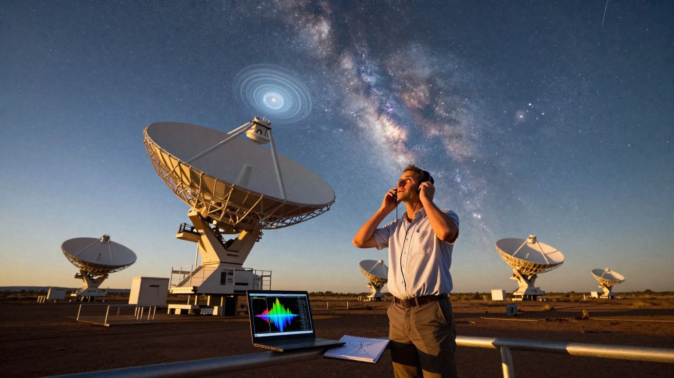
On 12 March 2026, Google announced two major additions: Immersive Navigation and Ask Maps. Both features are built on Gemini models and tackle a familiar driving frustration: too much information, not enough clarity - and a map that often behaves like a flat diagram rather than the world outside the windscreen.
"Google Maps is shifting from a flat map to a spatial driving environment with clearer guidance and direct communication."
The new 3D presentation is intended to make driving feel calmer because motorists no longer have to mentally “translate” what the map is trying to show. At the same time, the chat-style assistant is meant to make finding places more natural: you won’t need the perfect keywords, as you can ask in free-form language - closer to how you would speak to a person.
Immersive Navigation in Google Maps: turning the road into a 3D stage
With Immersive Navigation, Google Maps gradually moves away from the traditional, heavily simplified overhead view. Instead of stylised blocks, the app displays a genuinely spatial recreation of your surroundings. The foundation is Street View imagery and aerial photography, which Gemini analyses and assembles into a detailed 3D model.
Buildings, bridges, traffic lights - visible at a glance
In the updated view, far more elements appear that previously were only hinted at - or missing altogether. According to Google, this includes, among other things:
- clearly separated lanes with road markings
- visible traffic lights and stop signs
- pedestrian crossings and zebra crossings
- buildings, bridges, and changes in road elevation
This is expected to matter most at confusing junctions, slip roads, or multi-lane intersections. Rather than following a line on a flat map, drivers can see how everything sits in space: where the turning lane runs, where the carriageway narrows, and where a ramp actually leads.
Transparent buildings and smart zooming for tricky moments
A key part of the revamp is how Google Maps uses perspective. At critical points, the app automatically zooms in and makes some buildings partially transparent so the road layout and lanes remain unobstructed. That should make it easier to judge which exit or lane the guidance is referring to.
Anyone who drives in large cities with tightly packed junctions will recognise the classic problem: the map says “turn right”, but there are several right turns in quick succession. The new view is meant to reduce those last-second swerves and panic manoeuvres.
A new navigation voice style
Alongside the visuals, Google is also reworking spoken guidance. The familiar robotic delivery and fixed phrasing is being replaced with a more flexible tone. Instead of “turn right in 300 metres”, prompts can be adapted to the situation, for example: “Go past this exit and take the next right.”
These instructions are intended to align more closely with what drivers actually notice - a visible exit, an unmistakable turn, a distinctive building. The voice should sound less like it is reading out a list of numbers and more like practical direction.
"Google says it processes several million traffic data points per second - from congestion and accidents to flooding."
On top of that, the community submits millions of updates each day, such as reports about roadworks, closures, or obstacles. All of this data feeds into route calculations and also underpins the new 3D navigation.
Clearer guidance on alternative routes
Google Maps is also changing how it presents alternative routes. The app has long offered multiple options, but the trade-offs were not always obvious at a glance. In the update, Maps is more explicit about what each route is asking you to compromise on.
Typical cases include:
- a fast but paid route with tolls or an inner-city charge
- a free route that takes longer but may involve less congestion
- a particularly fuel-efficient option with a lower average speed
This is intended to help people choose more deliberately whether saving time, reducing costs, or minimising stress matters most. For commuters on fixed routes, that can pay off day by day as traffic conditions and roadworks change quickly.
Ask Maps in Google Maps: a chat assistant for complex place questions
The second major addition sits in search rather than turn-by-turn guidance. Ask Maps is a conversational assistant built directly into Google Maps. It runs on Gemini, which can interpret free-text queries.
Normal sentences instead of keyword-style searches
Until now, searching in Google Maps often meant thinking in “search engine” shorthand: “Italian restaurant central London”, “24h petrol station Manchester”, “supermarket open Sunday”. With Ask Maps, natural phrasing is enough, such as:
- “Show me cosy cafés where I can still work after 22:00.”
- “Where can I find family-friendly hotels with a pool near a ski area?”
- “Which neighbourhoods are lively in the evening but not too loud?”
The assistant is designed to understand these requests, match them against location data, ratings, and opening times, and then highlight suitable options on the map.
Contextual answers, not just lists
What stands out is that Ask Maps is not limited to producing a plain results list. Responses can include context - for example, why a place is being suggested, common pros and cons, or how you might combine several stops on one journey.
| Function | Everyday benefit |
|---|---|
| Free-text requests | No exact terms required; normal language is enough |
| Gemini analysis | Connects ratings, photos, and location data |
| Contextual answers | Provides reasons and guidance, not just places |
For travellers, this could feel closer to having a personal guide: you ask for quiet beaches, child-friendly restaurants, or interesting areas for an evening walk - and receive suggestions that go beyond distance and price alone.
What this means for drivers and travellers
The pairing of a 3D view with a conversational assistant is clearly aimed at reducing stress. Anyone juggling lots of distractions - dense urban traffic, unfamiliar roads, children in the back seat - may benefit from a map that behaves more like an “explained environment”.
At the same time, reliance on the app increases. The more decisions Maps prepares for you, the easier it becomes to neglect your own observation of the road and surroundings. Users should keep in mind: the 3D view is an aid, not a replacement for attention.
It will also be interesting to see how Ask Maps affects traditional review platforms. If the assistant compresses ratings, photos, and experiences into concise recommendations, many people may lean more on the summary than on long reviews. That can speed up searching, but it can also hide nuance.
If you want to use the new Google Maps, it helps to understand a few terms in advance: Gemini refers to Google’s AI models, used here to analyse both image data and text queries. Immersive Navigation is the 3D driving view, while Ask Maps is the chat layer inside the app. The two modules connect when you ask questions about places along your route while planning.
This may be particularly compelling on holiday: a family plans a drive, asks for a playground with a café halfway, chooses a toll-free but calmer route, and then navigates using a view that renders the area with real depth. Those are the kinds of scenarios Google is targeting with the update - first in the US, then gradually in other regions.


Comments
No comments yet. Be the first to comment!
Leave a Comment